Southern States Co-op: An Inside Look At Our Aerial Imagery Program
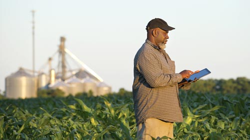 With UAVs (Unmanned Aerial Vehicles) inching closer and closer to legal status in the U.S., aerial imagery could soon become one of the most valuable tools used on the farm, both at the grower as well as at the crop consultant level.
The precision ag technology allows growers to monitor crop health and take action in troubled areas before it’s too late. Images taken from above, whether by drone, satellite or airplane, give a whole new perspective on how fields are performing. Like other precision ag products, aerial imagery programs can save growers a lot of time and effort, while increasing profitability by way of higher yields.
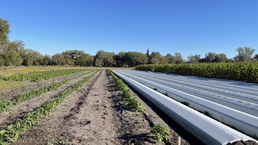
In the Southern States Co-op (CropLife 100 No. 9 ranked retailer; 2014 revenue in the $200-$999 million range) aerial program, aircraft equipped with cameras fly fields and capture images at one meter, one-half meter or one-quarter meter resolution. The quality of the post-processed image has a higher resolution than that of satellite imagery, typically five meter resolution, and is comparable with UAVs.


In 2014, Southern States focused on expanding its airplane aerial imagery program, and that will only continue throughout the new year. The Richmond, VA-headquartered company initially implemented its imagery program over 4,000 acres this summer in order to determine how aerial imagery can benefit crop production. The program provides three unique perspectives to growers:
- Aerial View. Also known as the Red, Green, Blue (RGB) image, is a standard image of the land from the airplane — a real-time aerial photo.
- Near Infra-Red. This image shows the heat and reflectiveness of vegetation in the field. Brighter red areas typically indicate more vegetation, but more heat could also mean weed pressure and not just better crop production.
- Multi-spectral or Normalized Difference Vegetative Index (NDVI). This image is a combination of the RGB and Near Infra-Red images. This image shows the field’s vegetative vigor or potential health of the crop.
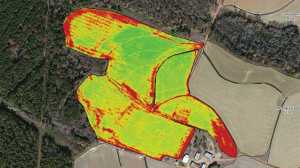
NDVI map.
All three of these image types give a different perspective on the crop and can help identify potential limiting factors preventing the crop from producing to its full potential.
Considering Limiting Factors
“Typical limiting factors that may be identified are moisture, nutrients or compaction,” says Dave Swain, manager of precision ag technologies at Southern States. “Most farmers know where the good and bad producing areas are in their fields. We aren’t really telling them something that they don’t already know. What we are identifying is to what extent those areas are being limited in their production, quantifying those limitations and what we might be able to do to eliminate those limiting factors within the season, rather than finding out the impact after it’s too late to do anything about it, typically as the crop is being harvested.”
As with many things on the farm — and in life — timing is everything. Southern States’ imagery program believes a three-shot program has the potential to be the most economical and cost effective solution. The timing of each image must coincide with key points during the crops’ growing cycle:
- Emergence. This timing shows how the crop is starting out and if there may be any possible mechanical issues with the planter/seeder.
- Early growth stage (typically between three and five weeks after emergence). This is an opportunity to verify that the crop has adequate key nutrients, if there are any potential disease issues or if there is potential yield robbing weed pressure.
- Three weeks before flowering. An opportunity to identify potential crop health issues that can be remedied so that the crop can be healthy going into flowering for optimal pollination.
“The images at these stages allow growers to see and identify problems early so they could take action effectively,” Swain explains.
Large and small farms alike can benefit from this technology, as can ag retailers looking to add the service to an existing precision ag offering. The size of the operation is not the determining factor in using any technology tool or service. According to the Southern States team, the key is using the tools to make crop production and management changes to remove limiting factors to get the most out of every acre, every bag of seed, every pound of fertilizer and every ounce of crop protection product.
Subscribe Today For
