Save up to $2 million in data engineering costs and months of development time with a turnkey geospatial solution

Geospatial analysis is critical for turning agronomy and climate science into answers, but some of the most popular tools aren’t efficient in scaling beyond a few project areas. By providing a fully-supported, highly scalable, and affordable geospatial platform, data science teams can save up to $2 million in data engineering costs and months of development time with Descartes Labs compared to building out their own solution.
Users can ingest, process, analyze, visualize, and export massive amounts of data at scale, and access pre-built algorithms for biomass, deforestation, tillage, cover crops, and more, all carefully assembled by our team of applied scientists. That’s why innovators look to us to experiment, prototype, and productionize their raster data analytics.
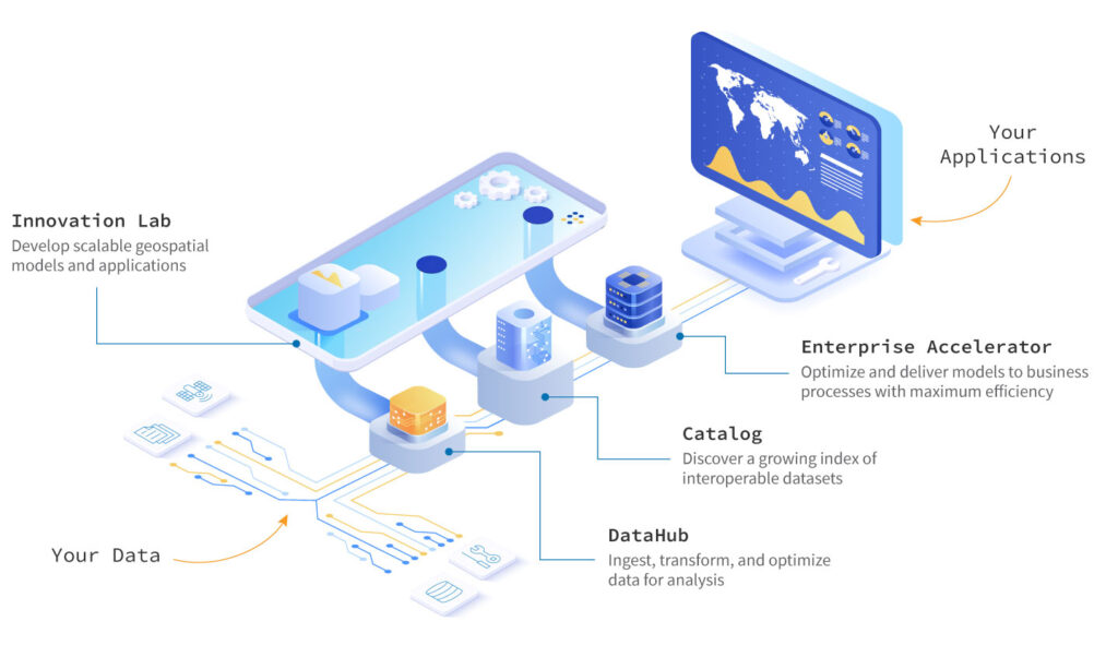
Get models into production faster with the flexible data ingest, compute power, and market access of the world’s leading geospatial platform. Transform your science into production with Descartes Labs.
Check out our recorded workshop and see for yourself!
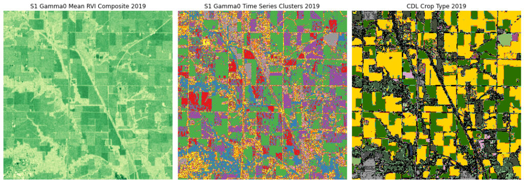
Workshop: Leveraging Sentinel-1 for Agricultural Insights
In this recorded technical workshop, we explore globally processed Sentinel-1 (S1) SAR and InSAR data products available on the Descartes Labs Platform. We’ve simplified working with S1 data by processing the entire catalog available from the European Space Agency (ESA), from raw data (SLCs) to a variety of derived level 1 and 2 data products. These data products enable rapid iteration in research and development workflows. We examine how users can best access and interact with them to build meaningful agronomic applications.