UAVs: Taking Agronomy To New Heights
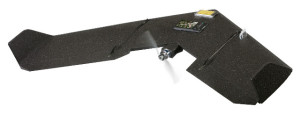
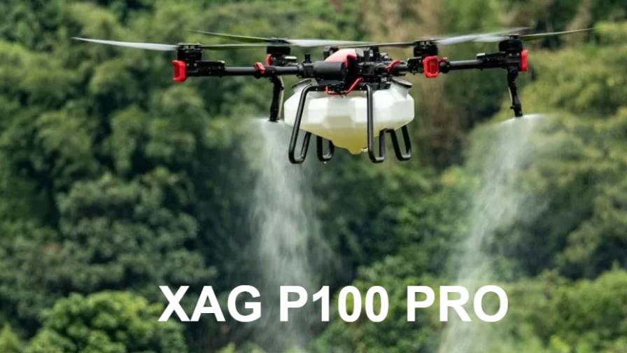
Drones are unmanned, meaning that they fly on a predetermined flight path.
Dale Cowan, a Certified Crop Advisor based in southwestern Ontario, is part of the region’s largest co-op, AGRIS Co-operative Ltd. AGRIS is a large farm input supply co-op owned by southwestern Ontario farmers. As senior agronomist, it is part of Cowan’s responsibility to provide quality agronomic and grain marketing solutions for his customers.
That means being a leader — and staying a leader — particularly when it comes to precision farming technology. AGRIS recently added a new member to their ever-expanding team — an Unmanned Aerial Vehicle (UAV) or drone.
New Teammate
AGRIS serves over 1,200 members, says Cowan, and over 5,000 farmers in Essex, Kent, Lambton, Middlesex and parts of Elgin County. “We offer pretty extensive precision ag services,” says Cowan, “but wanted to provide another layer of information for our customers.”
“We do the standard soil sampling that everyone does. We get yield monitor data from farmers on the combines. Not all farmers have yield monitors. Not all farmers are mapping yield and not all yield maps are particularly useful at times,” says Cowan. “Getting a look from above the crops, we know the fields are inherently variable and the crops tell us that by yielding differently.”
The drone began work in March 2013. Its first job was to take bare-ground images in the spring. Getting an aerial view, says Cowan, is another way to look at the differentials across the field. To do so, the drone takes images using either a standard digital camera or an infrared camera several times throughout the season.
“The nice thing about the drone,” says Cowan, “is that it’s totally autonomous. We can fly it in any field we want at any time — weather permitting, of course. We don’t have to access satellites or buy large tracks of imagery from other aerial platforms. It’s something we can do on a field-by-field basis.”
Obtaining Permission
Without a doubt, the most difficult part of the venture has been getting the permits to fly. In Canada, in order to fly you need what’s called an SFOC — Special Flight Operations Certificate — from Transport Canada. The first step in the process is to submit an application to let Transport Canada know the intended flight path. The application should also include technical information about the unit itself. Most importantly, though, the person operating the equipment must demonstrate a working knowledge of airspace. This is, perhaps, the most difficult part of the process, as it requires extensive knowledge of the surrounding airspace and its rules and regulations.
Drones are unmanned, meaning that they fly on a predetermined flight path. This raises obvious concerns for Transport Canada, who want to know that it can be controlled at any time.
“If you’re using a remote control, then it’s not considered unmanned,” says Cowan. “If it’s unmanned, you have to have permits. The process takes anywhere from six to eight weeks
to get that permit.”
Transport Canada’s Website does show what they’re looking for in an application, but Cowan knew it wasn’t going to be that easy. He opted to taked an abbreviated ground school program so that he could better understand airspace.
“They just want you to be able to demonstrate your ability, not only to fly your craft, but to also understand the rules of the airspace that you’re operating in,” says Cowan.
Airspace Rules
The first step is to understand the difference between controlled and uncontrolled airspace, says Cowan. The five nautical miles of space surrounding an airport is considered controlled airspace.
“You can still fly there, but you have to file what is called a ‘notam’ that says that you will be in the area at this time period, at this altitude at this coordinate,” says Cowan. “It lets other people who might be in the area know that you’re in the area and they’ll stay away from it. When you’re done flying, you lift the notam with Nav Canada.”
You still have to have a working knowledge to fly outside of controlled airspace, says Cowan, who uses a guide that shows every single airstrip in Ontario, including grass strips that farmers have registered. He has to know if he’s within three to five nautical miles of any one of them, and must file a notam to let people know that he’s in the area. If he’s outside of that, in what is considered Class G airspace, then it’s open-sky policy.
“We fly at 400 feet,” says Cowan. “No other commercial airplane should ever be below 500 feet. Technically, we should never run into each other. On approach and takeoff, of course, these planes are going to be below 500 feet, so I have to know where I am relative to an airstrip.”
Learning Lessons
As expected, the first year was not without its challenges. In fact, Cowan says he learned quite a few valuable lessons. First, he learned that the drone could only be flown under the right conditions, which was sometimes a limiting factor.
“If you can’t spray, you can’t fly,” he says. “And there were an awful lot of days where you couldn’t fly.”
He also learned what factors would cause image variations. Topography, for one, creates lighter and darker spots in the images. Also, the time of day the images are taken can have an impact on quality as well. When the sun is overhead, says Cowan, you can actually pick up the shadows of plants on the ground.
The crop’s stage can also impact image quality — a lesson Cowan learned when wheat crops started to head. “When the head starts to come out it’s a totally different green color than the rest of the plant, so you have to adjust the readings on your final maps,” he says.
“We quickly learned that the field does indeed have to be bare ground, too,” says Cowan. “Any residue on the ground covered the image. Those with ground cover were unsuccessful.”
Perhaps the biggest lesson, though, is learning how to manage customer expectations. “Like anything in precision ag,when you get a map, basically what the map tells you is where you need to go and practice good basic agronomy,” says Cowan. “The drone doesn’t give you answers. It just gives you an image.”
“My advice?” he concludes. “Have a very clear idea of why you want one. Some of the things that people are looking for include formal scouting, foliar diseases and when to put chemicals on. I just look at it as another tool, and a different view. And the view from above is always more revealing than the one at ground level.”

