FarmQA Adds Map Layers to Expand Suite of Digital Tools for Agronomists
FarmQA, an ag tech company that builds digital tools for agronomists, has announced the general availability of map layers for the FarmQA suite.
The map layers feature provides advanced spatial layer visualizations within FarmQA. This capability allows users to easily import spatial data layers generated from other precision ag tools, such as Planet satellite imagery, into FarmQA. Once imported, the visualizations can be viewed with the FarmQA web or mobile app, equipping agronomists and soil consultants with more of the data they need to diagnose challenges and problems.
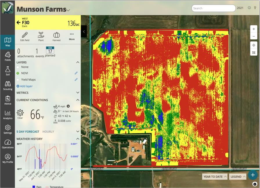
View the NDVI map layer for directed scouting to determine current position relative to crop canopy, plant stand populations or weed density.


“With the addition of layers, I’m now able to view a variable rate seed map as the background while I check plant populations in the field,” says Josh Hammond, agronomist and owner of FarmAssist Consulting in Dickinson, ND. “This helps me target exactly where I need to be counting for each zone so I can get reliable information.”
Integration with Planet satellite imagery enables agribusinesses with a Planet satellite imagery subscription to easily import current global agriculture imagery into FarmQA. Planet imagery is automatically processed for each field and available offline on mobile and within the FarmQA web application.
“Planet and its subscription API are a great fit with FarmQA map layers,” says Paul Bramel, vice president of engineering, FarmQA. “Planet’s ability to send us just the information that our customers are interested in reduced the amount of code we needed to write and enabled us to get the processed images into our customers’ hands as quickly as possible.”
Features and benefits of map layers include the ability to:
- Import visualizations of agronomic, topographic, weather, moisture information, and more.
- Import from precision ag sources like GK Technology, John Deere, QGIS, Google Earth Pro, GeoJSON, Planet and others.
- Upload layers as KMLs or shapefiles to view within FarmQA’s web or mobile applications
- Import raster and vector file formats.
“Our engineering team continues to expand and improve the functionality for crop consultants,” says Howard Dahl, founder and CEO at FarmQA. “And this release provides further proof of our commitment to listen to our customers and use their feedback to guide our product roadmap. Map layers takes us one step further towards getting all data that’s meaningful to an agronomist under one roof.”
Subscribe Today For
