Nebraska Getting Water Conservation Right
A precipitation map of Nebraska looks startlingly like a rainbow, with each colored band marking a different level of rainfall. Moving from east to west across the state, rainfall amounts diminish drastically, from more than 30 inches in the eastern quarter to just 14 to 18 inches in the western panhandle.
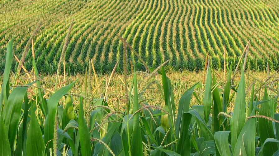
Growing wheat, corn and soybeans is a challenge in the semi-arid west; hence, growers have long used irrigation. With rises in crop prices, traditional dryland producers in the east — who at times face harmful fluctuations in precipitation — have turned to irrigation as well, installing center pivots as an insurance plan so they can be guaranteed at least some yields every year, explains Dr. Bill Kranz, professor and extension irrigation specialist with the University of Nebraska-Lincoln.
In fact, Nebraska has now become the state with the most irrigated acres in the U.S. Most water used for irrigation is groundwater, drawn from the High Plains Aquifer. One of the largest aquifers in the world, this vital water source underlies approximately 175,000 square miles across eight states, including Texas, New Mexico, Oklahoma, Kansas, Colorado Nebraska, South Dakota and Wyoming.


Approximately two-thirds of the almost three billion acre-feet of water in the High Plains Aquifer (which includes the Ogallala Aquifer) is under Nebraska. Stakeholders at the state and local level are taking a multifaceted approach in preserving this resource, which is facing dangerous draw-down levels in other states.
Governing Water
Nebraska has developed some unique and effective ways of governing its water resources.
For one thing, since 2004, groundwater and surface water have been treated and managed as one entity — a key factor in balancing water use in the state. Water allocations take into account all sources users draw from. “Our Department of Natural Resources is now required to do a water balance in each one of our watersheds or subwatersheds every year,” says Kranz.
In addition, Nebraska has created 23 Natural Resource Districts (NRDs) with geographies drawn to follow river basin boundaries. In contrast, other states use county or township boundaries to set up soil and water conservation districts.
“This encourages customized management decisions for the unique hydrology of a particular portion of a basin,” explains Nate Jenkins, assistant manager of the Upper Republican Natural Resources District. It also helps with management of hydrologically connected groundwater and surface water supplies.
Districts are given both regulatory and taxing authority. Regulations can cover allocating of groundwater, augmenting surface water, requiring flow meters, instituting well drilling moratoriums, requiring water use reports and restricting the expansion of irrigated acres. Districts can use taxes to employ staff to record pumping levels, for instance, or to supply conservation projects.
Bottom line: Instead of groundwater management being centralized in state government, groundwater management decisions in Nebraska are left largely to the locally governed and elected NRD boards, with input from the state’s Department of Natural Resources. This local control allows NRDs to use regulations and monies in different combinations and to different degrees depending on the needs and concerns of a specific geography.
Growers’ Part
Jenkins says the NRDs’ efforts are just part of Nebraska’s efforts to manage water. Growers have been conserving water in a number of ways, from converting from flood to pivot irrigation, to adopting water-saving technology, to planting drought-resistant hybrids.
He feels Nebraska agriculture is generally very progressive, with players willing to try “the next new technique or equipment that can reduce inputs without jeopardizing yields.”
One example: The Upper Republican Natural Resources District (southwest corner of the state) has provided cost-shares for soil moisture probes for the past three years. “Even as commodity prices have dropped, demand for the probes has stayed strong, and the program incentivized the use of them on approximately 27,000 acres,” Jenkins says.
All but two of the 170 probes purchased under the program have been the newest generation of probes — with telemetry that relays soil moisture data to farmers’ computers with recommendations on whether to irrigate. “Variable-rate irrigation is gaining a strong foothold in the area, and I believe zone control through variable-rate application will grow in popularity,” Jenkins says.
Dealers have begun to play an important role as their customers try to control water use more. “One of our key priority areas within Central Valley Ag Coop (CVA) and our precision ag department is water management,” says Glen Franzluebbers, ag technology director at CVA, York, NE. “It’s what we have been talking about with our customers.”
CVA offers full-service irrigation management services to its growers, via its branded AquaSystems program. Tools offered include soil moisture probes, pivot telemetry systems and variable-rate irrigation prescriptions.
“But we want to make sure that these services are geared towards what the grower needs,” says Keith Byerly, advanced cropping systems manager. “We have developed a system to make data-driven decisions on where probes are placed, so growers get the best bang for their buck out of them. I think the biggest mistake the early adopters of this technology are making is not being vigilant enough in where the probes are placed in the field. That single detail often makes the difference between success and failure.”
CVA has nine precision ag service specialists who not only use the data to place moisture probes, but also write VRI prescriptions locally for growers. AquaSystems uses a combination of EC and RTK elevation change data, along with real-time soil moisture data, to make the most accurate and timely irrigation scheduling recommendations.
Company advisors can also incorporate a full service scouting program if a grower wants to get even more information from his fields moisture-wise.
CVA makes the in-field part of the system as hands-off as farmers want by doing all of the probes’ installation, service and removal for them, Byerly explains. The firm’s three equipment technicians also install the FieldWise pivot control systems that CVA sells to help monitor and control pivots.
Subscribe Today For
