


ArcGIS is a comprehensive system for data science that leverages artificial intelligence (AI) and machine learning (ML) techniques to support agribusiness. In this Tech Talk from Tech Hub LIVE, ESRI’s Mark Dann and Dr. Elvis Takow discuss how ArcGIS provides a powerful platform for analyzing and visualizing agricultural data, enabling agribusinesses to gain valuable insights and make informed decisions. With ArcGIS, agribusinesses can integrate and analyze various types of data, such as satellite imagery, weather data, soil data, and crop yield data. AI and ML algorithms can be applied to this data to identify patterns, predict crop growth and yield, detect diseases or pests, optimize irrigation and fertilizer usage, and much more.

Most Read
-
CropLife Retail Week: Syngenta President Retires, Corn and Soybean Harvest Delays, and EPA Biofuel Shift
-
Helping Growers Diversify: How Ag Retailers Can Guide Farmers Beyond Corn and Soybeans
-
Precision Fertilizer Blending®
-
From Selling Inputs to Selling Outcomes: How Ag Retailers Can Prove Their Value to Growers
IRON Featured Products
- NL7 SeriesFrom New Leader
- Autobatch™ with Dual 13-Ton Rotary Blenders & 8 HoppersFrom Doyle Equipment Manufacturing Co.
- Sackett-Waconia AccuBlend™ systemsFrom Sackett-Waconia
- SMART Design Series – Raised Valve HandleFrom TerreMax®
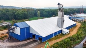
- Armor Building: Built for Fertilizer Storage PerformanceFrom Legacy Building Solutions
- VPA 1000 TenderFrom Titan Machinery





Upcoming Events
Newsletter
The ag retail brief, twice a week
Input pricing, distribution moves, and the equipment that actually ships.
Free · unsubscribe anytime